A tunnel cut by hand through the rock. Tuna anchors rusting in the dunes. A red sea stack rising out of the Atlantic. Fifteen beaches of unusual nature, off the mass-tourism trail — with today’s access, the care they need and the way there on the map.
Map: Portal Turismo Portugal, from CAOP 2025 boundaries and coastline (DGT, CC BY 4.0).
Bare rock
Costa Vicentina and Vila do Bispo
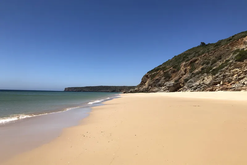
Between Sagres and Aljezur the coast lies inside the Southwest Alentejo and Vicentine Coast Natural Park. Here the secret is the rock: black schist, red sandstone, limestone hollowed into caves. You get there on dirt tracks or on foot, and none of these beaches has a lifeguard.
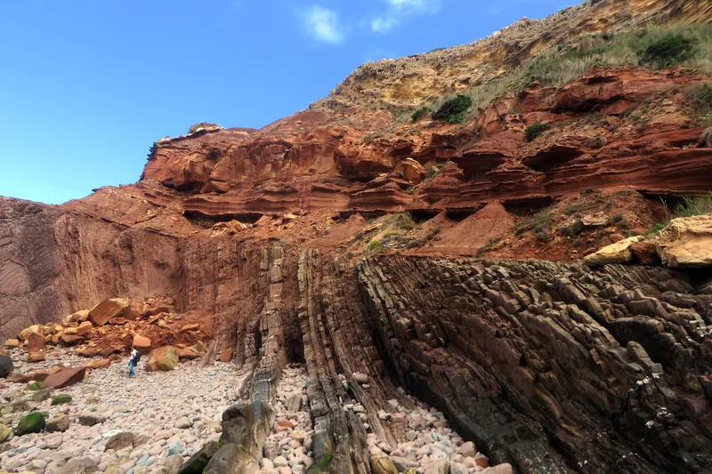
At the northern end, red Triassic sandstone sits on Carboniferous shale tilted almost vertical.
The last beach before Cape St Vincent holds one of Portugal's best-known geological outcrops: an angular unconformity where red Triassic Silves sandstone caps Carboniferous shale and greywacke, folded and tilted during the Variscan orogeny. Tens of millions of years of rock record are missing between the two. You reach the sand on foot down a steep path through the limestone ledges of the cliff; there are no facilities and no mobile signal on the beach. The outcrop is at the northern tip, Ponta dos Ouriçais: get close only at low tide with a calm sea, over the pebbles and the rock platform, never by climbing.
Steep footpath · no facilities or signal
Not a designated bathing water: no lifeguard. No mobile signal on the beach (rescues have been needed). Reach the outcrop only at low tide in calm seas; do not climb the cliff — it is a protected geosite with fragile, protected plants.
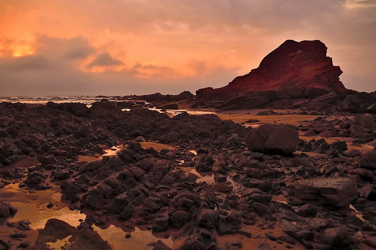
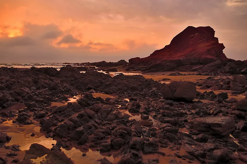
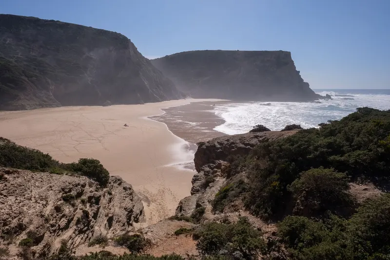
It takes its name from a great reddish rock rising from the sea between black shale cliffs.
Between Cape St Vincent and Castelejo, this beach of dark shale cliffs has an unusual contrast: at its southern end rises a large reddish sea stack, the Ponta Ruiva, beside which breaks a wave well known to surfers. Access is by dirt road off the Sagres–Cape St Vincent road, then a moderate path down the cliff. The last stretch of track is rough for low cars and signposting is poor. There is no bar, no toilets and no shade, so bring water and food. At high tide much of the sand disappears.
Dirt road + moderate footpath
Not a designated bathing water: no lifeguard. Big waves and submerged rocks — swim only when the sea is calm.
You can only get there on foot, down a valley of fig and olive trees — and the ruins of a fort sit on the eastern cliff.
It lies between Salema and Zavial, but the car stays behind: the informal parking area is about a kilometre from the sand, and the rest is on foot along a narrow path through a valley of fig and olive orchards, with limestone outcrops pocked by caves. The cove is small, enclosed by oddly shaped, warm-coloured cliffs; on top of the eastern cliff stand the ruins of the Forte de Vera Cruz da Figueira. There is no lifeguard and there are no facilities. In winter and early spring the stream may mean hopping across stepping stones, and at high tide the beach shrinks.
On foot · c. 1 km through the valley from parking
Not a designated bathing water: no lifeguard or facilities. Cliffs can shed rock — don't settle at their base. The stream can cut the path in winter.
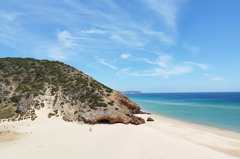
The central cliff is black shale streaked with red and orange veins, and dune plants run almost to the water's edge.
Between Cordoama and Amado, it is one of the few beaches where dune vegetation reaches almost to the tideline. The central cliff is black shale shot through with red and orange veins; to the north the cliff is pale and deeply sculpted, and the sand is scattered with oddly shaped, multicoloured boulders from old rockfalls. Rock pools form at low tide. Access is via about 6 km of dirt road off the EN268, unsigned, south of the Pedralva turn-off; it deteriorates after rain. There is no lifeguard and no facilities: bring everything and take your rubbish home.
6 km dirt road off the EN268 · no facilities
Not a designated bathing water: no lifeguard. Strong currents — swim only in the middle of the beach, away from the ends. The stream can run high in winter. The dirt road needs a suitable vehicle.
It is named after its furnas: deep hollows and caves the sea has carved into the foot of the limestone cliff.
A small south-west-facing beach east of Zavial, where a stream meets the sea. At its eastern end, erosion has hollowed the limestone cliff into the furnas that give it its name — large undercuts and caves at the base of the rock — while juniper scrub runs down to the sand, which the stream strews with small pebbles. Access is by dirt track from the village of Figueira, about 2 km away. It is an official bathing water, rated Excellent in 2025, but unlike Zavial it has no lifeguard. There are no toilets or restaurant, and parking is haphazard.
Dirt track from Figueira (c. 2 km) · no facilities
Designated bathing water (PTCN7X) but no lifeguard. Heavily eroded limestone: don't sit inside or beneath the cliff hollows.
It sits at the end of a valley of tall juniper, 4 km of dirt track from the last tarmac.
A small beach at the mouth of a valley of tall juniper and limestone outcrops, between pale cliffs sculpted by fresh and salt water; a little dune field forms west of the stream mouth. The pebbles, known locally as rebolinhos, are piled into half-moon windbreaks. Access is via about 4 km of unsigned dirt track from Raposeira (use GPS), or on foot along the clifftops from Ingrina in about 40 minutes. It is an official bathing water, rated Excellent in 2025, but has no lifeguard and no facilities: bring water and food.
4 km dirt track from Raposeira · or 40 min walk from Ingrina
Designated bathing water (PTCJ9T) but no lifeguard. Can be windy. The dirt track is rough and unsigned.
The golden limestone of the western Algarve has been carved by water into arches, sinkholes and sea stacks. The famous beaches fill up early; next door are coves you reach through a tunnel, along a clifftop path or only at low tide. These cliffs do fall: the councils ask you to keep away from the base.
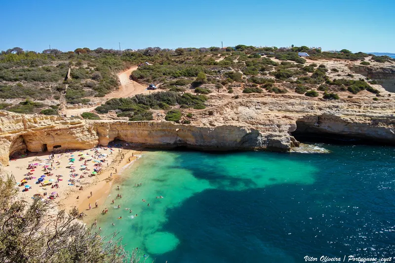
The only way onto the sand is through a tunnel cut into the rock.
Tucked into an angular bend of coast between Carvoeiro and Benagil, about 500 m from Benagil beach, Praia do Carvalho is a small golden cove between wind- and sea-carved cliffs, with a lone sea stack breaking the horizon. What sets it apart is the way in: a flight of steps, then a narrow, unlit, hand-dug tunnel through the rock with an uneven floor. There is no lifeguard, café or toilet, so bring water, shade and a bag for your rubbish. Parking by the access path is limited. Keep well away from the foot of the cliffs: the council warns the rock is unstable.
Steps and rock tunnel · limited parking by the path
No lifeguard (not a designated bathing water in 2026). Unstable cliffs with rockfall: don't settle at their base. The tunnel is dark with an uneven floor; cliff-jumping is not advised.
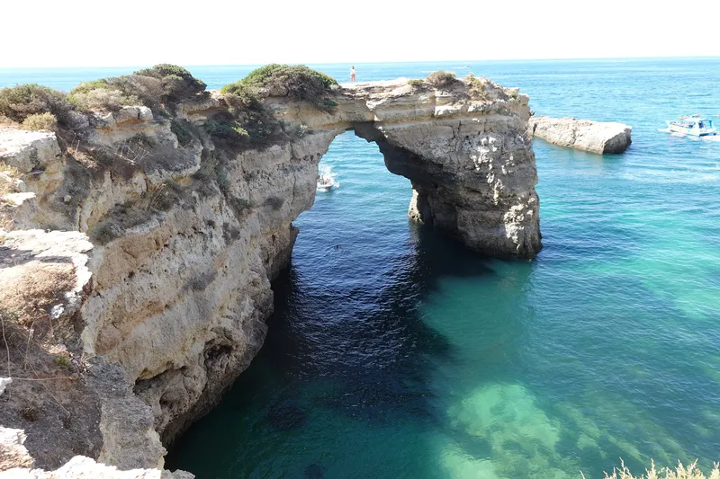
A rocky headland splits the beach in two, and next door the sea has punched an arch through the cliff.
The approach is a narrow 2 km lane winding between dry-stone walls and Mediterranean scrub, much like the farm tracks of the last century; the final 200 m is gravel. Below, a small headland divides Praia de Albandeira into two coves framed by lace-like cliffs. A few minutes' walk along the clifftop brings you to the Albandeira arch, a bridge of rock over turquoise water. From the car park at the top, a path and steps lead down. At high tide the sand all but disappears; low tide brings more beach and better snorkelling. In 2026 it has lifeguards from 1 June to 30 September.
Narrow 2 km lane · clifftop car park · path and steps
Rockfall and unstable-cliff signs are posted: keep back from the base and from the edge on the way to the arch. Swim under the arch only in calm seas and if you are a strong swimmer. Lifeguards only in the bathing season.
Two huge sea stacks planted on the sand, and a path of ravines and arches to get there.
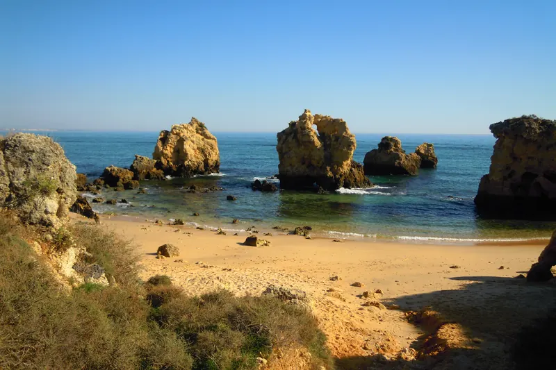
At the eastern tip of Lagoa, a few hundred metres from Praia do Vale do Olival, Praia dos Beijinhos is a small beach dominated by two massive sea stacks. The best way in starts at Vale do Olival: a narrow path along the clifftop through coastal scrub, looking down on gullies and rock arches. The council asks walkers to watch every step, as the cliff here is fragile. There is also a staircase from the road beside Vila Vita Parc. No lifeguard and no facilities. At low tide, rock pools form among the boulders.
Clifftop path from Vale do Olival · or steps by Vila Vita
Narrow path close to the edge of eroded cliffs: stay on it and keep back from the edge. No lifeguard. Don't scramble over the rocks on a rising tide.
Three giant sea stacks dominate one of Albufeira's smallest beaches.
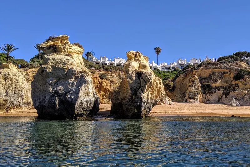
West of Albufeira, Praia dos Arrifes is a sheltered cove backed by low cliffs pocked with the sinkholes typical of this stretch of coast. Three huge sea stacks rise in front of the sand, their tops covered in salt-tolerant plants, which is why locals call it Praia dos Três Penecos. You park on an unsurfaced patch in the pine wood and go down a set of wooden steps. The beach is small and on some high tides the sand almost vanishes, so check the tide table first. It has lifeguards from 15 May to 15 October, and its water was rated excellent in 2025.
Unsurfaced parking in the pines · wooden steps
Rockfall from the cliffs: don't sit at their base. Very little sand at high tide. The wooden steps make it unsuitable for wheelchairs.
It isn't one beach but several: sandy coves separated by arches, caves and sinkholes.
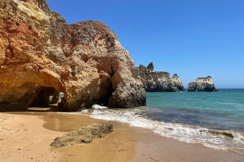
By the Ponta João d'Arens headland in Alvor, Prainha is a string of small coves divided by rocks that fresh and salt water have carved into arches, caves, sinkholes and ledges. Some coves can only be reached at low tide, which is also when you can walk over from Praia dos Três Irmãos, to the west, through the coves and grottoes. There is also a staircase down the cliff. Underwater, the rocks make it one of the area's favourite dive spots. Rockfalls are common, and Portimão's tourist board classes almost the whole beach as limited-use.
Cliff staircase · at low tide, on foot from Três Irmãos
Frequent rockfall (a partial cliff collapse in August 2022 was cordoned off by the Maritime Police). Keep clear of the cliffs, stay out of caves and head back before mid-tide on a rising tide. Not a designated bathing water in the 2026 order.
In the east the secret is sand: barrier islands between the lagoon and the sea, with no cars, reached by boat or over a footbridge. Some have lifeguards in the bathing season; away from the patrolled area and outside summer, nobody watches the water.
It is the Ria Formosa's only uninhabited barrier island — and home to the southernmost point of mainland Portugal.
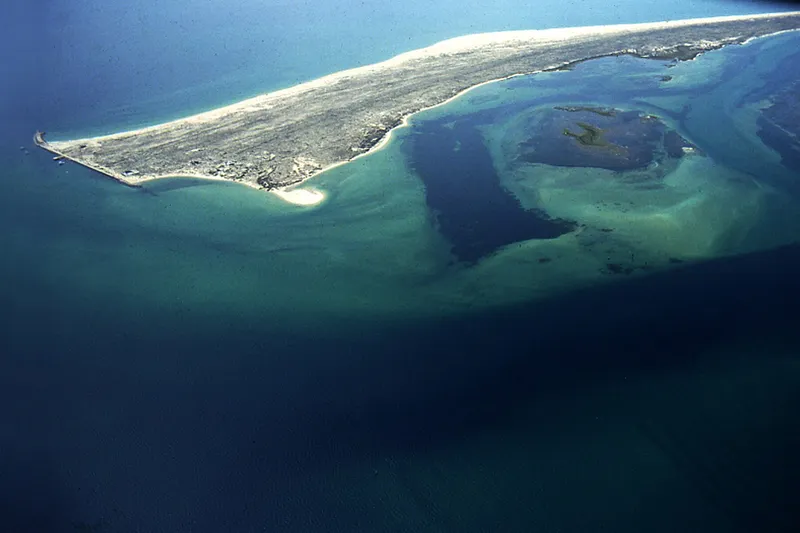
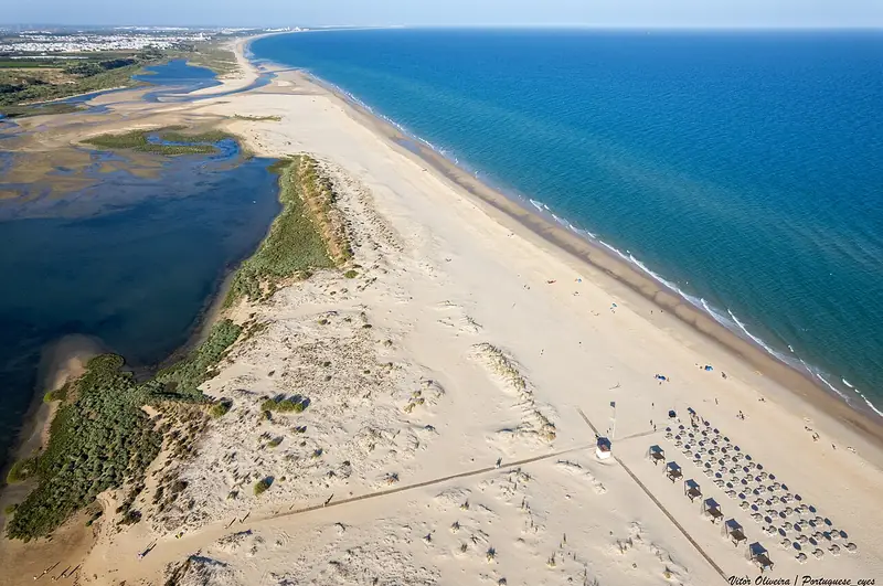
Ilha da Barreta, better known as Ilha Deserta, has no houses: the only building is the Estaminé restaurant near the jetty, which makes its own solar power and drinking water. From the landing, a wooden boardwalk crosses the dunes to Cabo de Santa Maria, mainland Portugal's southernmost point — not a rocky headland but a bend in the sand. The island runs for around 11 km between ocean and lagoon. Animaris boats leave from the Cais das Portas do Mar in Faro: the ferry takes about 45 minutes, the fast boat about 15. Part of the beach is licensed for naturism.
Boat only · 15–45 min from Faro (Cais das Portas do Mar)
Barreta is a lifeguarded bathing beach from 1 June to 30 September (Portaria 204-A/2026/1); away from that zone and out of season there is no cover. There is almost no shade. Check the time of the last boat back before wandering off from the jetty.
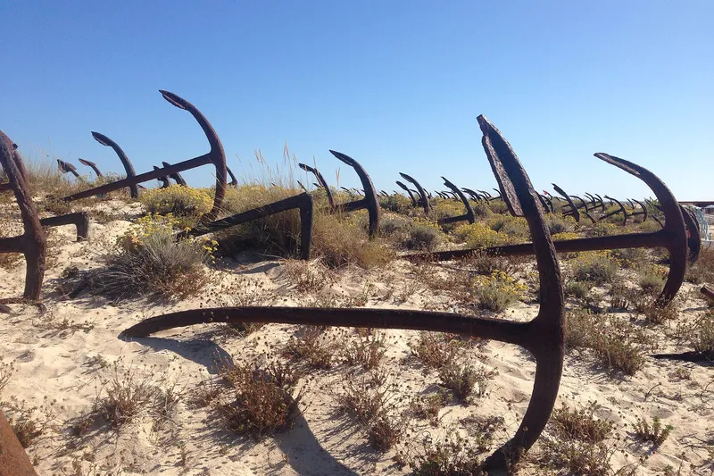
At the entrance to the beach, around 250 iron anchors lie rusting, half-buried in the dunes.
From 1841 to 1966 this was the site of the Armação do Barril, one of the tuna-fishing stations on the Tavira coast. When the industry ended, its anchors were left lined up along the dunes — about 250 of them — and the spot became known as the 'anchor cemetery'. The old station buildings now house the beach cafés and facilities. Start from Santa Luzia, beside the Pedras d'El Rei resort: cross the lagoon on a footbridge, then walk roughly 1 km or ride the little tourist train. The train has space for wheelchairs and pushchairs.
Footbridge + 1 km on foot or by tourist train · from Santa Luzia
Lifeguarded bathing beach from 1 June to 30 September (Portaria 204-A/2026/1); no lifeguards outside the season. The anchors are corroded iron — don't climb them or let children do so. Stay on the boardwalks and off the dunes.
37.1483° N · 7.5511° W · Vila Real de Santo António
From Cacela Velha you can see the white-sand island; the safe way across is a fisherman's boat that crosses the lagoon in under five minutes.
At the eastern end of the Ria Formosa, the Cacela peninsula is a strip of white sand cut off from the shore by the lagoon, directly opposite the village of Cacela Velha. Condé Nast Traveler's Spanish edition once ranked it among the world's 15 best beaches. The right way in is from Sítio da Fábrica, just west of the village: from May to October, small fishing boats make the crossing with no fixed timetable, leaving when there are passengers. You land at Praia da Fábrica, the lifeguarded stretch. There are no restaurants or shade on the sand, so bring water, food and a parasol.
Fishermen's boat from Sítio da Fábrica · under 5 min (May–Oct)
Fábrica-Mar is a lifeguarded bathing beach from 1 June to 30 September (Portaria 204-A/2026/1). Vila Real de Santo António council and the Maritime Authority advise against wading across the lagoon opposite Cacela Velha: on the ebb tide currents pull out to sea, there is no permanent lifeguard cover there and people are rescued every summer (around 60 in 2024). Take the boat.
You step off the boat into a car-free settlement of whitewashed houses, beneath a lighthouse first lit in 1851.
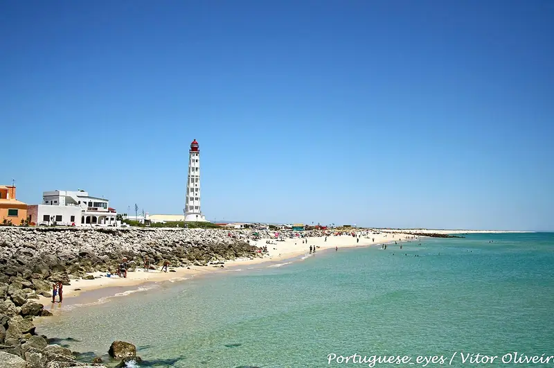
Farol is the western settlement of Ilha da Culatra, a Ria Formosa barrier island with no cars: from the jetty to the ocean beach you walk along a path lined with white houses and bougainvillea. The Cabo de Santa Maria lighthouse, around 46 metres tall, came into service in 1851 and was the first in Portugal to be fitted with a second-order Fresnel lens. Across the inlet lies Ilha Deserta. Scheduled boats run from Faro (Cais das Portas do Mar) or Olhão and take 40 to 50 minutes; water taxis are the alternative. From Faro, Farol sailings run mainly in summer.
Boat only · 40–50 min from Faro or Olhão
Ilha do Farol-Mar is a lifeguarded bathing beach from 1 June to 30 September (Portaria 204-A/2026/1). Outside that zone and season there is no cover. Ferries from Faro are seasonal — check the last boat back.
Rockfalls happen every year in the Algarve. Never lie at the foot of a cliff or sit on the edge; respect the risk zones signposted by the APA and the councils.
The tide rules
Some coves only connect at low tide. Check the tide table before you set off and head back before it turns.
No lifeguard
At most of these beaches nobody watches the water. Swim only in calm seas, and never alone.
Take everything back
Many of these beaches are in natural parks. There are no bins: your rubbish goes home with you. Keep off the dunes outside the boardwalks.
Frequently asked questions
Which is the most hidden beach in the Algarve?
It depends on what you are after. The most remote on this list are on the Vicentine Coast: Murração and Barranco are reached by dirt tracks (6 km and 4 km) and Figueira only on foot, about 1 km down a valley. None of them has a lifeguard.
Are there Algarve beaches you can only reach by boat?
Yes. Ilha Deserta (Barreta) and Ilha do Farol can only be reached by boat from Faro (or from Olhão, for Farol). For Praia da Fábrica, opposite Cacela Velha, the council and the Maritime Authority ask visitors to use the fishermen’s boat rather than wade across the lagoon.
Is it safe to swim at beaches without lifeguards?
It takes care. Most of these beaches have no lifeguard: only swim when the sea is calm, never lie at the foot of the cliffs and check the tide before walking between coves. Every beach page shows today’s sea and tides.
Do I need a car?
For the Vicentine Coast, yes: the Vila do Bispo beaches are far from public transport and several need a dirt track. If you hire a car, check the rental terms cover unpaved roads. In the east, the islands are done by boat or on foot.
When is the best time to visit?
Outside July and August there is more room in the car parks and on the small beaches. Where there is a bathing season, lifeguards only work the 2026 dates (generally June to September). For coves linked only at low tide, check the tide table.
Sources: municipal councils (Lagoa, Portimão, Tavira, Vila Real de Santo António), Algarve Tourism, Visit Portugal, APA (Portaria 204-A/2026/1 and 2025 water quality), IUGS (Telheiro geosite), Wikipedia and regional press (Postal, Sul Informação, Barlavento). Photos: Wikimedia Commons, with author and licence on each photo. The “Stay nearby” (Stay22), “Compare cars” (DiscoverCars), GetYourGuide tours and Amazon products are affiliate links: if you book or buy, we may earn a commission at no extra cost to you. As an Amazon Associate we earn from qualifying purchases. Access conditions change — check the signs on site before you go. Updated 12 October 2026.